http://ag.arizona.edu/oals/ALN/aln49/taylor2.html
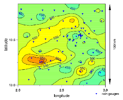
Isohyets are contour lines on a map that connect points that have the same amount of rainfall over a certain period of time. This map and its Isohyets show where the highest and lowest concentrations of rainfall were from May 1st to September 18th in 1992.
No comments:
Post a Comment